
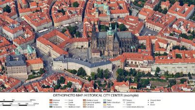
The “Urban Orthophoto Analysis of Historical City Textures in Urban Planning” project aims to investigate how modern urban development affects the historical skyline, architectural identity, and cultural texture of old city centers through drone-based orthophoto mapping techniques. Using the high-resolution aerial imaging and waypoint flight capabilities of the DJI Mini 4 Pro drone, students perform vertical mapping flights over historical urban areas to generate accurate orthophoto maps and visual documentation datasets.
The collected aerial data is analyzed to compare historical urban textures with newly developed structures, focusing on factors such as building density, roof patterns, street organization, green space distribution, and skyline compatibility. The project enables students to evaluate whether contemporary construction practices visually and spatially disrupt the original architectural character of historical districts.
Through geographic analysis, digital mapping, and visual interpretation methods, students explore the relationship between cultural heritage preservation and sustainable urban planning. The project also introduces fundamental concepts of photogrammetry, orthomosaic generation, urban morphology, and drone-assisted spatial analysis. By combining drone technology with urban studies and cultural conservation, the project promotes data-driven approaches for protecting historical city identities while supporting responsible urban development.