
Characteristics of Project-Based Learning
Subject: Professional Practice – Geodesy
Topic: Setting Out an Object (Construction Setting-Out)
Educational level: Upper secondary vocational education and training (VET)
Project-based learning on the topic Setting Out an Object focuses on the practical application of geodetic methods in real field conditions. Through project work, students acquire a comprehensive workflow for setting out a construction object—from the preparation of source documentation to accuracy control using modern technologies. The project connects theoretical knowledge of coordinate systems, levelling, and surveying instrumentation with the practical skills required for professional practice in construction and geodesy.
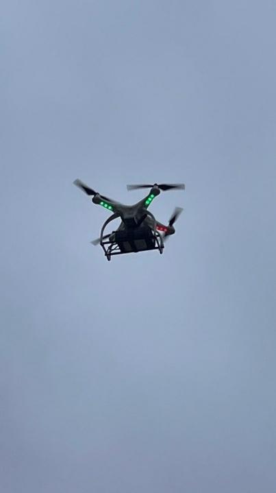
The core of the project is the planimetric setting-out of an object using orthogonal coordinates, where students work with design drawings, a baseline, and right-angle (rectangular) coordinates. Students then perform vertical setting-out using a levelling instrument, ensuring that the object is correctly positioned in terms of elevation. The project also includes control measurements using drones, enabling students to verify the accuracy of the setting-out, compare classical and modern measurement approaches, and analyse differences between the datasets obtained.
Project-based learning strengthens students’ independence, responsibility, and teamwork, as the activities are carried out in groups with clearly assigned roles. Students learn to plan the workflow, follow technical procedures and discipline, maintain a surveying field book, and evaluate measurement results. An important component is the development of digital competences through the processing of measured data and its graphical presentation.
A key benefit of the project is the integration of traditional geodetic procedures with modern technologies, helping students better understand the importance of accuracy and quality control in professional geodetic practice. The project develops vocational, technical, and workplace competences and prepares students for real situations they will encounter in further study or employment.
The project places particular emphasis on:
Use of modern measurement technologies – working with drones and GPS modules, planning flight routes, and collecting spatial data;
Professional geodetic competences – understanding coordinate systems, the planimetric coordinates used to set out the future object on the site, and their processing;
Analytical and technical thinking – processing measured data, evaluating GPS measurement accuracy, and comparing results with classical geodetic methods, including planimetric setting-out using the orthogonal method;
Practical skills – maintaining measurement documentation, processing data in software, and producing outputs such as tables, graphical representations, and evaluations of results from the classical method (levelling measurements, calculations, and graphical representation of the coordinate system—i.e., the setting-out plan) and the modern method (drone monitoring and GPS-based photogrammetry) for the purpose of assessing setting-out accuracy;
Responsibility and work safety – complying with drone operation rules, adhering to safety regulations, and ensuring the protection of people and property during field surveying activities.
Throughout the project, students complete all stages of geodetic work: from measurement preparation (including calculation of the X, Y coordinates of set-out points, planning the drone flight, and defining the methodology), through field measurements using a levelling instrument and a drone with GPS, to the processing and evaluation of results. The final output is a comprehensive report documenting the setting out of the planned object on the site, including an assessment of the accuracy of the geodetic work based on drone-based control measurements. The report includes a description of the technologies used, the measurement procedure, calculations, and an evaluation of accuracy.
This project-based learning approach supports active learning, increases student motivation, and prepares learners for real-world professional situations in modern geodetic practice, where unmanned systems and digital data are increasingly important.