
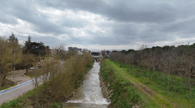
In this practical training activity, students monitor local stream conditions following periods of heavy rainfall, using a drone to assess water levels and identify potential flood risks. In some areas, flooding may have already occurred, while in others, the risk is still developing. Direct access to riverbanks can be difficult or unsafe due to high water levels, unstable ground, or fast-flowing water. These conditions make close-range observation challenging and highlight the importance of remote visual inspection.
Drone technology enables a safe and efficient method for observing water bodies without physical contact. During the activity, students learn how to prepare and operate a drone, plan safe flight paths, capture suitable visual data, and organize collected images and videos. The recorded materials are reviewed and documented to support a structured assessment of water level conditions and potential flood risks.
High-resolution aerial images allow students to observe key indicators such as increased water levels, changes in flow patterns, bank overflow, and sediment movement. One of the main objectives of the activity is to identify early warning signs of flooding and interpret these observations in a systematic way. Students also learn how drone-based monitoring can support rapid and informed decision-making in real-world situations without the need for advanced analytical tools.
Beyond technical competencies, the training emphasizes safety awareness, environmental observation, and responsible behavior. Students develop digital skills, teamwork, and problem-solving abilities while understanding the role of drone technology in disaster preparedness and response. The activity simulates real-life conditions where timely monitoring of water systems is essential for reducing risk and improving resilience. Overall, the activity prepares students to contribute to flood risk assessment and environmental monitoring in a practical, safe, and effective manner.