
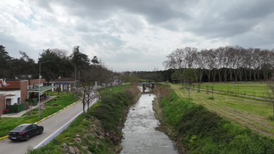
In this practical training activity, students assess changes in surface water turbidity following natural disasters such as earthquakes, floods, or landslides by using drone-based visual inspection. After such events, increased sediment transport, erosion, and debris flow can significantly affect water quality, often leading to higher turbidity levels. Direct field measurements may be difficult or unsafe due to unstable ground conditions, strong currents, or restricted access. Therefore, drone technology provides a safe, efficient, and non-contact method for observing and evaluating these changes.
During the activity, students learn how to prepare and operate a drone, plan safe and effective flight paths along rivers or streams, and capture high-resolution images and videos of water bodies. Special attention is given to identifying visual indicators of turbidity, such as changes in water color, suspended sediments, flow disturbances, and sediment deposition near banks. Students organize and interpret the collected visual data to distinguish between normal and abnormal water conditions.
The recorded images and videos are reviewed, classified, and documented in a structured way, forming the basis of a simple environmental assessment report. This process helps students develop observation, analytical thinking, and reporting skills, while also improving their digital competence and ability to work collaboratively in field-based scenarios.
Beyond technical skills, the activity emphasizes environmental awareness, safety, and decision-making in post-disaster contexts. Students are encouraged to consider how increased turbidity may impact ecosystems, infrastructure, and water usability. By simulating real-world disaster conditions, the training highlights the role of drone technology in rapid environmental assessment and supports the development of practical skills for disaster preparedness and response.