
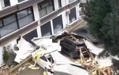
On 8 January, a severe storm affected the Darica district, causing significant damage to the roofs of residential buildings, schools, and public facilities. Strong winds led to displaced roof tiles, detached metal sheets, damaged insulation layers, and an increased risk of water leakage. Conducting post-storm damage assessments using traditional methods exposes inspection teams to serious safety risks, particularly falls from height and unstable roof structures.
This lesson plan introduces students to drone-based post-disaster roof damage assessment as a safe, efficient, and modern alternative to conventional inspection techniques. Students will operate a drone equipped with a high-resolution camera to inspect rooftops from a safe distance, capture visual data, and identify different types of storm-related damage.
The collected aerial images will be analysed and classified according to predefined damage and risk criteria. Based on this analysis, students will create a Roof Damage and Risk Map, supporting decision-making for emergency repair prioritisation. Through this real-life disaster scenario, learners will understand how drone technology contributes to occupational safety, disaster response, and smart urban management.