
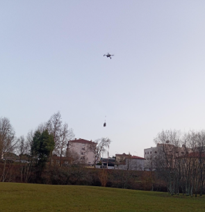
This project explores a drone-based approach to environmental data collection by investigating how particulate matter (PM2.5) concentrations vary vertically in a natural park environment. Traditional air quality monitoring methods are generally limited to ground-level measurements, providing an incomplete picture of how pollutants behave at different altitudes. By utilizing a commercial DJI drone equipped with a custom-built PM2.5 sensing system, students can safely gather critical vertical data.
Students will set up an air quality logger consisting of an ESP8266 microcontroller, a PM2.5 sensor, a GPS module, and an SD card. They will securely attach this logger to the drone as a suspended payload, allowing measurements to be collected at multiple heights without interfering with the drone's onboard safety sensors. Students will plan a vertical flight path, pausing at specific altitudes to collect stable readings.
After completing the flight, the students will extract the SD card data and map it in three dimensions using Kepler.gl. By analyzing how PM2.5 concentration changes both across space and vertically above the ground, students will develop practical technical skills, an understanding of spatial data mapping, and a deeper environmental awareness of airborne pollutants